Drone Mapping Processing Service
For Wyoming Operators & Surveyors
Based in Casper, Wyoming (150 N Center St), Precision Drone Ops provides commercial Part 107 pilots, civil engineering teams, and earthwork contractors across Natrona County, Cheyenne, Gillette, and the Rocky Mountain West with rapid 12–24hr photogrammetry processing. Turn your raw drone photos into survey-grade 2D orthomosaics, 1ft DXF contours, and cut/fill volume models in NAD83 Wyoming State Plane coordinates.
Why Wyoming Drone Pilots & Surveyors Partner With Us
Processing drone imagery flown over Wyoming high desert, rugged sagebrush terrain, and energy corridors presents unique elevation and wind challenges. We understand the local geography and client expectations.
Wyoming State Plane Coordinate Precision
We deliver your deliverables georeferenced directly to EPSG:32156 (Wyoming East), EPSG:32157 (Wyoming Central), or EPSG:32158 (Wyoming West) with NAVD88 vertical elevations in US Survey Feet. Ready for instant drag-and-drop into AutoCAD Civil 3D, Carlson Survey, QGIS, and ArcGIS.
High-Plains Terrain & Wind Compensation
Wyoming wind causes subtle gimbal drift and rolling terrain causes scale distortion. Our bundle adjustment algorithms rigorously align tie-points, filter sagebrush and grass noise, and construct sharp terrain surfaces without ground artifacts.
Eliminate $7,000 Workstation Bottlenecks
Don't tie up your field laptop or local workstation for 14 hours baking dense point clouds. Drop your flight folder to our dedicated multi-GPU node at the end of your flight day and have deliverables in your inbox the next morning.
Civil Construction & Earthwork Volumes
Need cut/fill volume calculations for highway grading, subdivision pads, or aggregate stockpiles? We generate 32-bit floating point DSM elevation grids and deliver accurate volume reports with TIN surfaces.
Energy Sector Confidentiality & NDA
Supporting critical infrastructure, oil & gas, transmission lines, or mining? All imagery is processed locally in Casper on encrypted hardware and purged automatically after 30 days. Mutual NDAs gladly provided.
White-Label Delivery for Solo Pilots
Offer full-scale photogrammetry and CAD contours to your clients under your own brand. We remain completely invisible, giving your solo operation the output speed of an enterprise survey division.
Case Highlight: 120-Acre Subdivision in Natrona County
See how a regional Part 107 mapping operator leveraged Precision Drone Ops for rapid overflow processing during peak construction season.
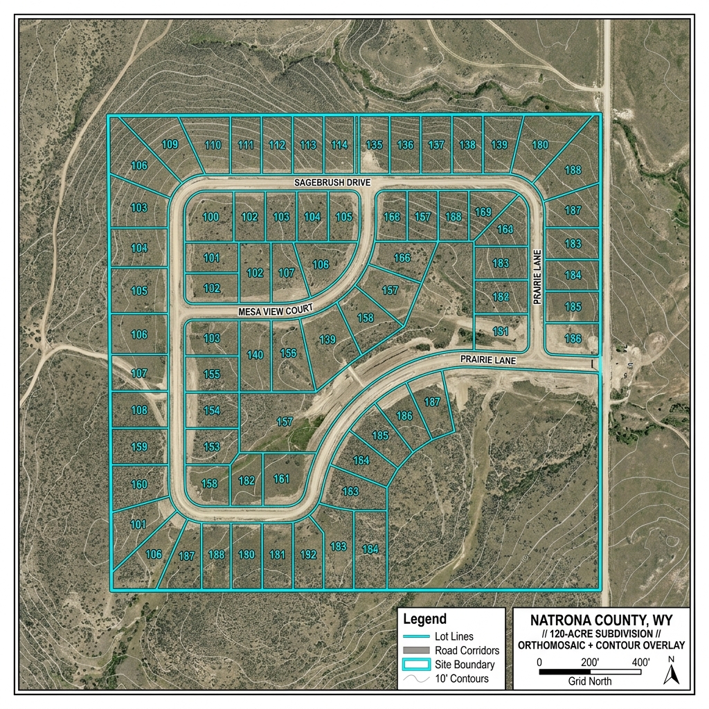
"Used for overflow on a 120-acre subdivision in Natrona County"
"When our in-house workstation was tied up during the summer construction surge, we sent 480 raw RTK frames from a 120-acre residential subdivision outside Casper to Precision Drone Ops. Within 18 hours, Kelton delivered sub-1.5cm GeoTIFF orthomosaics, clean 1-foot DXF topographic contours that snapped cleanly into AutoCAD Civil 3D, and a verified DSM elevation model with zero coordinate drift. Having a dependable photogrammetry lab partner right here in Wyoming keeps our flight crews billing in the air without computing bottlenecks."
Wyoming Deliverable Package Specifications
Every dataset submitted to Precision Drone Ops is rigorously calibrated, inspected for bundle-adjustment error, and delivered in industry-standard CAD and GIS formats.
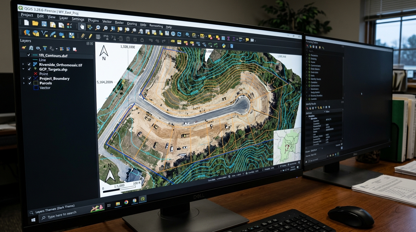
2D GeoTIFF Orthomosaic & 1-Foot Contours
High-resolution orthorectified aerial map perfectly aligned to Wyoming State Plane coordinates. Delivered with DXF and Shapefile vector contour layers ready for AutoCAD Civil 3D.
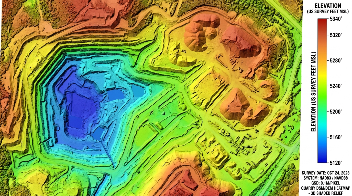
DSM Elevation Model & Stockpile Volumetrics
32-bit floating point digital surface model with false-color elevation tinting and 3D hillshade. Enables cut/fill grade assessment, drainage flow analysis, and gravel stockpile volumes.
Transparent Processing Tiers
No expensive software subscriptions or hardware investments required. Pay only per dataset with our fast 12–24 hour target turnaround.
Starter Dataset
Small commercial site or single parcel
- Up to 350 raw photos
- High-Resolution GeoTIFF Orthomosaic
- Google Earth KMZ overlay
- NAD83 WY State Plane or WGS84
- 12–24hr Turnaround Target
- 30-Day Auto File Purge
Pro Mapping & Contours
Subdivisions, grading sites, and civil engineering
- Up to 900 raw photos
- High-Res GeoTIFF Orthomosaic
- 1ft / 2ft Topographic Contours (DXF & SHP)
- Digital Surface Model (DSM/DEM)
- Ground Control Points (GCP) alignment
- White-Label Delivery Option
- Priority 12–24hr Turnaround
Enterprise 3D & Volume
Quarries, mines, stockpiles & large acreage
- Up to 2,500 raw photos
- Dense 3D Point Cloud (LAS/LAZ)
- Stockpile Cut/Fill Volume Report
- High-Res Orthomosaic + Contours
- 3D Textured Mesh (OBJ/FBX/GLB)
- White-Label Client Delivery
Ready to Process Your Wyoming Drone Dataset?
Paste your Google Drive, Dropbox, or OneDrive link. We'll run a complimentary overlap and GSD quality check and send you a feasibility report within 12–24 hours.